
BSc Surveying Engineering and Mapping
Department:
Program level:
Credits (ECTS):
Frequency:
Description
Objectives:
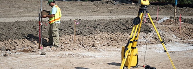
Surveying Engineering and Mapping is a rapidly developing discipline that focuses on spatial information, i.e. locational information. It comprises the science, technology, and art involved in the measurement, representation, analysis, management, retrieval and display of spatial data concerning both the Earth’s physical features and the built environment. Surveying Engineering and Mapping includes the disciplines of land boundaries cadasters, geodesy, photogrammetry, remote sensing, mapping, geographic and land information systems, spatial computing, computer vision, and surveying business. It has applications in all disciplines which depend on spatial data, including environmental studies, planning, engineering, navigation, geology and geophysics, oceanography, land development, land ownership, land administration and land use management. It is thus fundamental to all the geosciences disciplines which use spatially related data. Students in Surveying Engineering and Mapping will be taught the principles and techniques of field measurements and adjustments, boundary, topographic, geodetic, route and construction surveys. They apply classroom knowledge in laboratory exercises with modern surveying equipment including theodolites, electronic distance meters, electronic total stations, Global Positioning System (GPS) satellite receivers, and optical alignment devices. Mapping topics include Geographic Information Systems (GIS), photogrammetry and remote sensing. In laboratories, students develop maps from field measurements, design and layout construction projects, plan subdivision developments and establish horizontal and vertical control using satellite geodesy. Microcomputers are used extensively in reducing data, planning field layouts, plotting boundaries, drawing (CAD) plats and map production.
Prerequisites & Requirements
-
Exit Level Outcomes
Graduate Profiles: BSc Surveying Engineering and Mapping
At the end of the program participants will be able to:
- Implement procedures for the use and care of surveying field equipment.
- Perform a boundary survey and preparation of a map using appropriate standards and laws.
- Perform typical land surveying activities including, topographic, volume, as-built, control, geodetic, and subdivision surveys.
- Design residential subdivisions including lot layout, roads, drainage and dams.
- Perform coordinate calculations on the State Plane Coordinate System and transformations to other coordinate systems.
- Identify the surveyor’s role in a land information system (LIS).
- Identify the surveyor`s role in all Civil Engineering structures and constructions.
- Perform surveying activities in irrigation and dam construction.
- Perform surveying tasks for road construction such as collection of route data, changing route and topography data into usable formats using surveying and engineering software, carryout calculations on earthwork, quantity and other office works.
- Identify careers in Surveying Engineering and Mapping and be committed to the profession and lifelong learning, ethical and safe practices, and respect diversity and societal issues in practice.
- Design as well as analyze and interpret spatial data.
- Utilize the techniques, skills, modern scientific and technical tools necessary for Surveying Engineering and Mapping practice.
- Utilize available surveying and geo-information technologies and systems for the acquisition, updating, maintenance and dissemination of information pertinent to cadastral maps and Conduct office and field verification on accuracy of a map.
Individual Clients
-
Other stakeholders
-